

How are areas mapped?
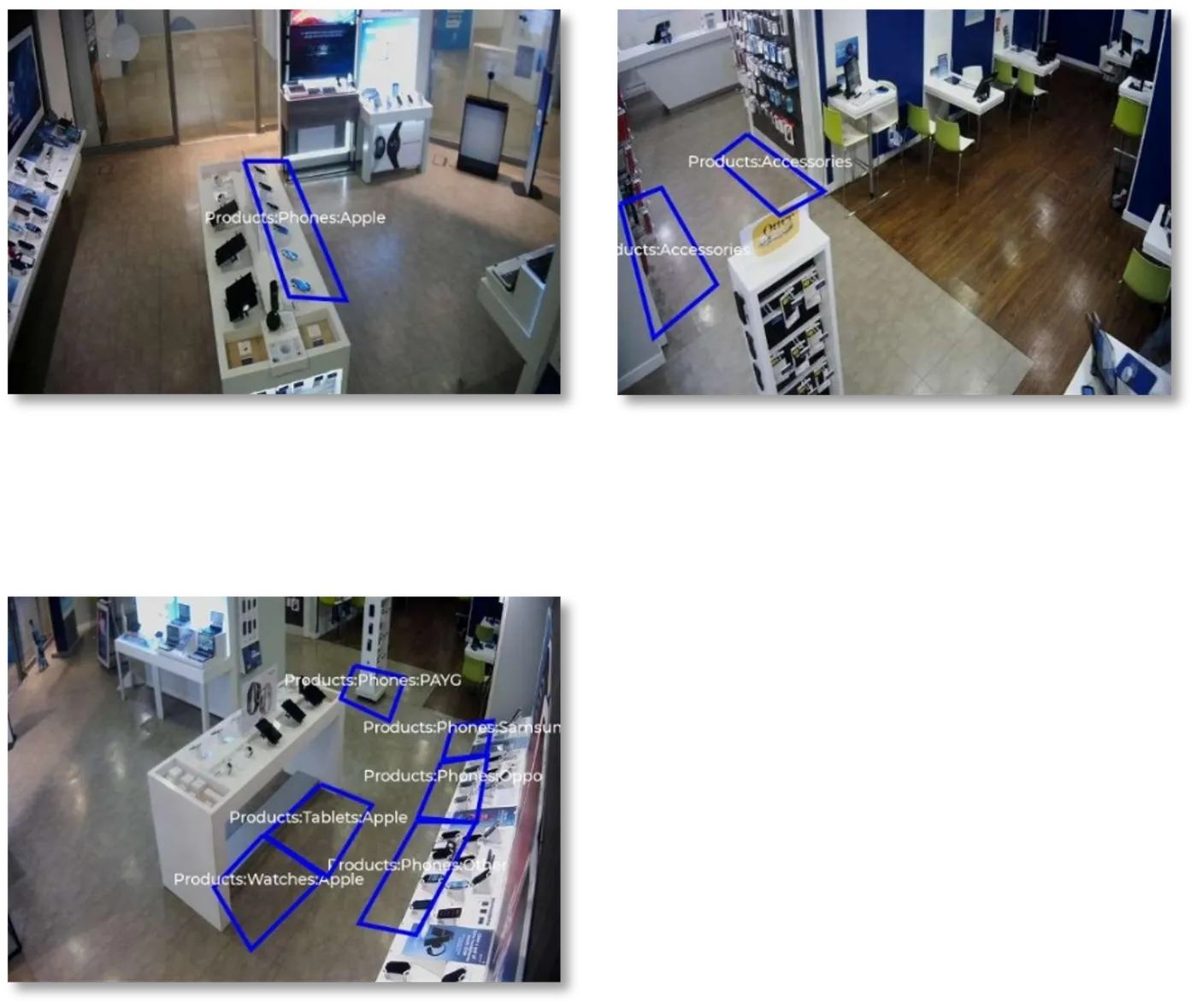
Areas are mapped by drawing polygonal shapes on the camera view during setup. Each shape becomes a tracked area — departments, checkouts, fitting rooms, service desks — and is fine-tuned against ground-truth audits.
Areas are mapped by drawing polygonal shapes on the camera view during setup. Each shape becomes a tracked area — Footwear, Womenswear, Checkout, Fitting Rooms, Service Desk — and the AI uses those boundaries to attribute every entry, dwell and demographic split.
How the mapping is done
- Camera frames captured. Our setup team takes a still from each connected camera covering the relevant floor space.
- Boundaries drawn. Polygon shapes are placed on the still — usually one polygon per real-world area you want to measure. The polygon traces the floor, not the merchandise, so the area follows where customers stand.
- Sub-areas grouped. Several polygons can roll up into a parent area. For example, Menswear might contain Accessories, Footwear and Suits — each independently tracked and summed up into a single department.
- Accuracy audit. Once mapped, the team verifies counts against ground-truth video samples and adjusts the boundaries if needed.
Examples of product areas
When areas need re-mapping
- The store is refit and merchandise moves.
- A camera is repositioned (intentionally or after maintenance).
- New zones are added — a pop-up display, a seasonal department, a new fitting room cluster.
To request re-mapping, get in touch at support@auravision.ai with a brief description of what’s changed.